A trip to Tanzania requires careful planning; it is not the kind of destination to approach without a clear itinerary. Routes matter here, and so does understanding how different regions connect. Most journeys begin in Arusha, but what happens after that depends on how far someone is willing to travel by road and how comfortable they are with distances that don’t look significant on a map but take hours in practice.
The road network links everything, but not always directly. This makes the experience feel less like ticking off locations and more like moving through connected ecosystems, where wildlife, communities, and conservation efforts overlap in ways that aren’t always obvious at first.
Immersive Conservation Encounters Across Tanzania
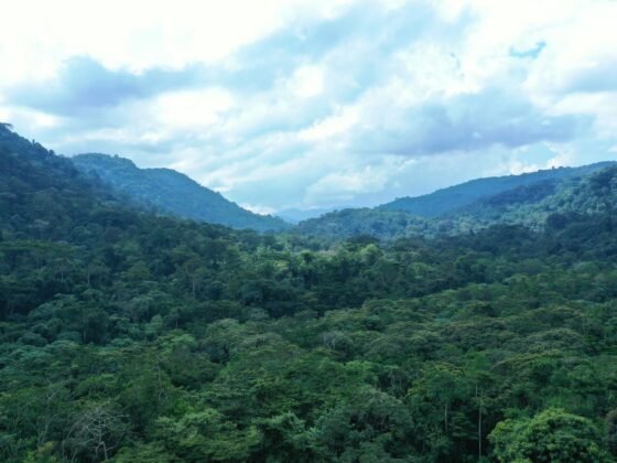
Arusha works as the main entry point, especially around the Clock Tower area where most vehicles head out early in the morning. From there, the A104 runs west toward places like Meserani, where roadside markets stretch along the highway, before splitting toward Tarangire and Lake Manyara.
Around Tarangire’s northern edge, near Sangaiwe Gate, conservation work is more visible. This is where incredible luxury Tanzania safari holidays often connect directly with anti-poaching work and wildlife monitoring efforts. Some camps sit just outside the park boundary, which allows guides to explain how wildlife corridors function between protected areas and village land.
The route through Mto wa Mbu is worth slowing down for. The main street runs straight through the village, with stalls selling produce, timber, and handmade goods. It’s one of the few places where the link between tourism and everyday life is obvious.
Witnessing the Great Migration in the Serengeti
Getting into the Serengeti isn’t quick. Most vehicles pass through Ngorongoro Conservation Area, climbing past the Loduare Gate before reaching the crater rim road. From there, the track continues toward Naabi Hill Gate, which marks the official entry into the Serengeti.
The migration moves depending on rainfall, so routes shift throughout the year. Between June and August, the western corridor near the Grumeti River becomes active. Vehicles usually follow the main Seronera road before branching off toward river crossings, where movement builds gradually.
Seronera sits at the centre of the park, with an airstrip and ranger station that act as reference points. Tracks extend in every direction, but they aren’t well-signposted. Guides rely on radio updates and experience to decide where to go next. It’s common to drive across open plains for long stretches, then suddenly encounter concentrated wildlife near a single water source.
Protecting Rare Species within the Ngorongoro Crater
The descent into the crater starts from lodges along the rim road, usually near areas like Lemala. Vehicles line up briefly at the Seneto descent track before winding down through forest and onto the crater floor, with access carefully managed to limit pressure on the ecosystem.
Black rhinos are a focal point here, though sightings aren’t guaranteed. Rangers monitor movement closely, particularly around Ngoitokitok Springs, where animals tend to pass through open areas. The terrain makes tracking easier than in other parks, but protection still depends on timing, patrol coverage, and controlled access.
The Lerai Forest, toward the southern side, offers a different setting. Elephants move through shaded sections here, especially later in the morning. From there, tracks lead toward Lake Magadi, where flamingos gather along the shoreline depending on water levels. Getting between these areas is easy once inside the crater, with well-used dirt roads linking each zone while keeping movement within defined routes.
Most vehicles exit the way they came in, climbing back toward Karatu. Within a short distance, the landscape shifts again into farmland, with small roadside stalls marking the edge of the conservation area and a clear boundary between protected land and daily life.
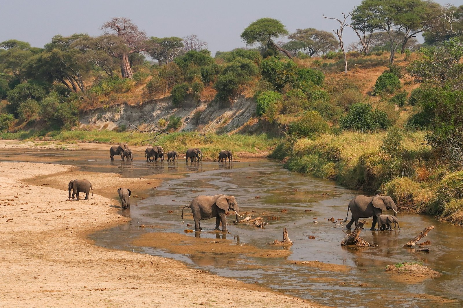
Traversing the Elephant Corridors of Tarangire
Tarangire sits closer to Arusha than the Serengeti, but it feels more enclosed once inside. The drive follows the road past the Usa River and Minjingu before turning off toward the park gates. After entry, the terrain opens out into baobab-dotted plains, with the Tarangire River running as the main feature through the park.
Elephants tend to follow this river, particularly during the dry season when water sources elsewhere disappear. Tracks running alongside the river are the most active, especially between Silale Swamp and the southern reaches toward Kuro. Herds move slowly across these routes, often stopping vehicles for extended periods.
Near Sangaiwe Gate, along the northern boundary, movement extends beyond the park itself. Wildlife corridors link Tarangire to the surrounding community land, which is why conservation work here focuses on keeping those routes open. Travelling through the area gives a clearer sense of how animals move between protected and unprotected spaces without fixed boundaries.
Primate Conservation Efforts in the Mahale Mountains
Reaching the Mahale Mountains isn’t that easy. Most journeys begin in Kigoma, a lakeside town on the edge of Lake Tanganyika, accessed by small aircraft from Arusha or Dar es Salaam. From there, boats head south along the shoreline, often taking several hours to reach the park. There are no roads into Mahale, which keeps visitor numbers low and limits movement once inside.
Chimpanzee tracking is the main focus here, particularly with the M group, which has been studied for decades. Treks usually start from camps near the lakeshore, moving inland through forested slopes. Trails aren’t fixed in the way they are in other parks. Guides follow recent sightings and vocalisations, which means each outing takes a slightly different route.
Conservation efforts are closely tied to long-term research, with strict limits on how many people can visit the chimpanzees each day. Movement is controlled not just to protect the animals, but also to reduce the risk of disease transmission. Getting to Mahale takes more effort than most places in Tanzania, but once there, the focus shifts entirely to the forest and what lives within it.
Which species will you help protect?
Travelling through Tanzania brings people into contact with more than just wildlife sightings, with each region highlighting specific species under pressure. Elephant corridors in Tarangire depend on safe movement beyond park boundaries, the Serengeti’s wildebeest migration only continues if those routes remain open, and Ngorongoro’s black rhino population relies on constant monitoring. In the Mahale Mountains, chimpanzees are protected through strict limits on human contact and ongoing research.
Seen together, these places aren’t separate stops but part of a wider system, where the survival of each species depends on how well these landscapes are managed and connected.
Photo by Florian Müller on Unsplash